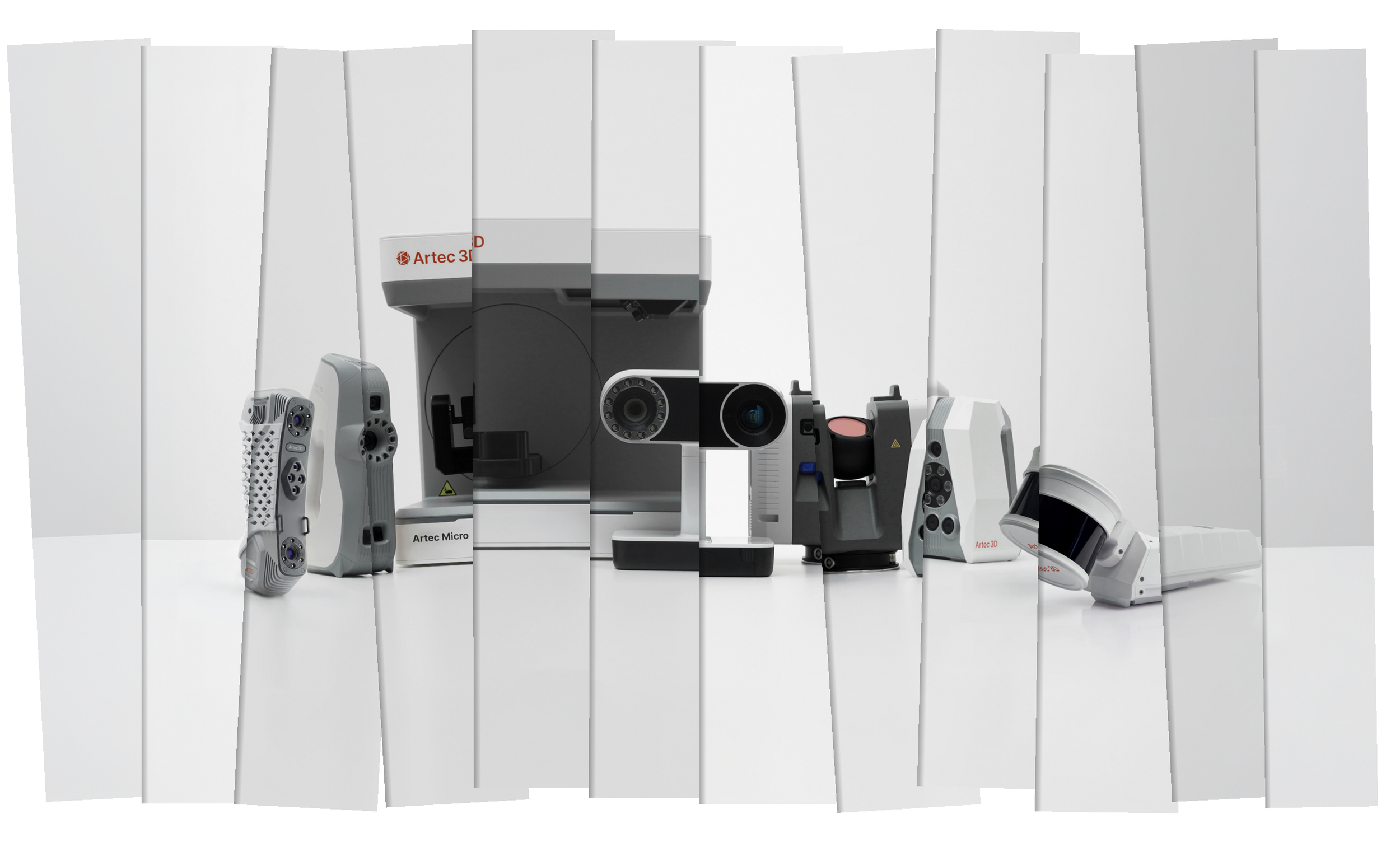
3D Scanner Types and How They work
Structured Light
Structured light scanners like the Spider II and the Leo work by projecting a pattern onto a surface. Since they know what this pattern should look like on a flat surface at a given distance, and what size the features should be, they can calculate the shape and size of the object being scanned based on how that known pattern distorts and changes size as it’s projected onto the object. This results in a single 3D surface, or frame.
In the case of handheld structured light scanners, these frames may be captured many times per second, overlapping each other to some degree. They can then be aligned with each other using one of several methods. Most scanners use one method or the other, but some have the ability to do both.
Method 1: By relating their relative positions with scanning targets applied in advance
Method 2: By using feature recognition to match them up, similarly to how panoramas are made by matching up features in the overlapping areas. The latter method can work with geometry, photographic features, or both simultaneously.

laser triangulation
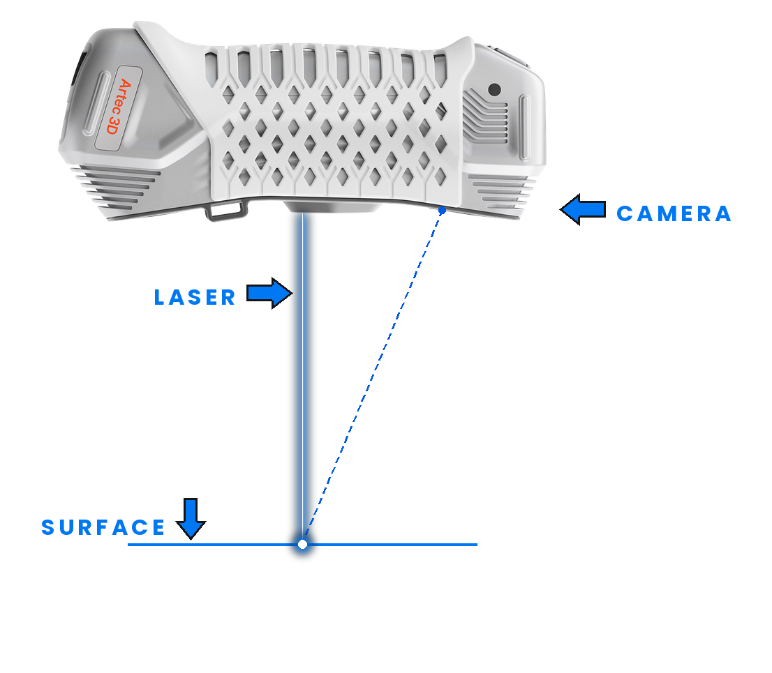
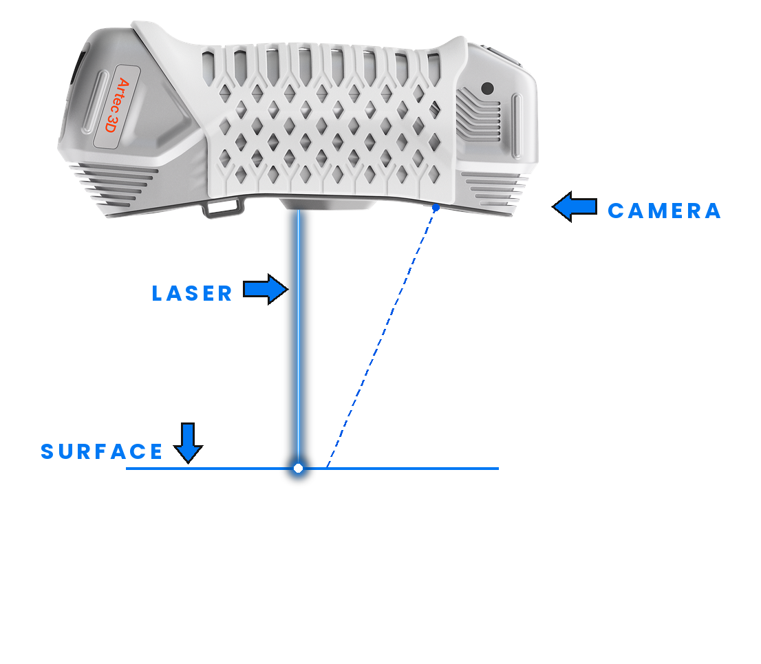
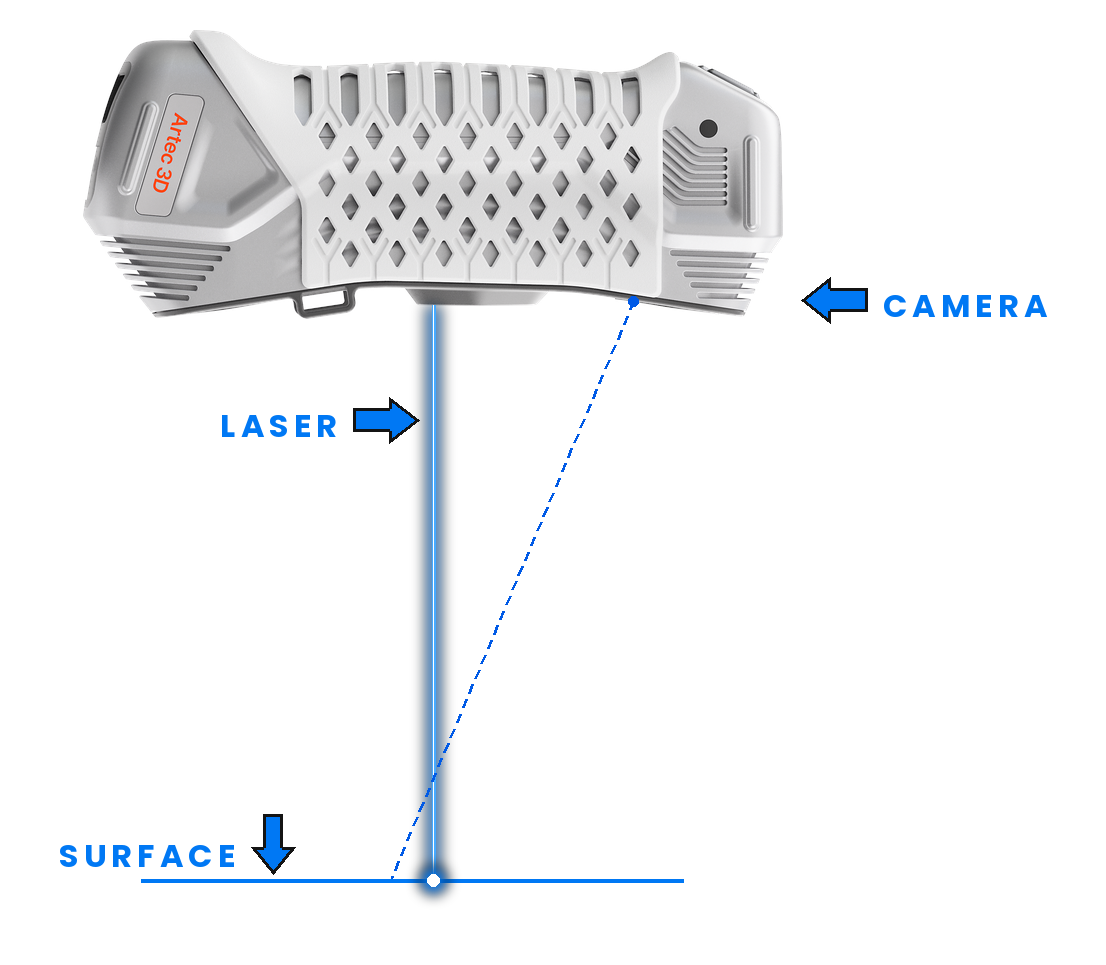
Most non-LiDAR laser scanners (laser-based handhelds like the Point II for instance) work by a method called laser triangulation. The principle is simple. A camera and a laser emitter are arranged in a triangular configuration so as to converge on a set focal point. We can see in the example below that if the scanner moves closer to the surface, the laser will appear further to left in the camera’s field of view. If it moves away from the surface, the laser will instead appear further to the the right. So we can calculate the exact distance from the camera to the surface based on where the laser appears in the camera’s view. The scanner does this many times per second, giving us many individual laser profile lines. Targets applied in advance then allow the software to map all these individual line profiles together into a cohesive surface.
LiDAR
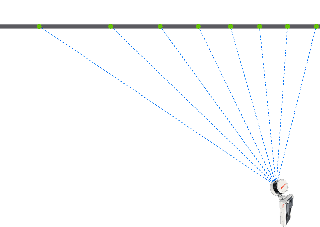
LiDAR (Light Detection and Ranging) works by sending rapid laser pulses from a rotating emitter. Some LiDAR scanners work by sending discrete pulses (time of flight), while other works by producing identifiable patterns in a continuous beam (wave modulation). In either case, that pulse bounces back and is captured by a sensor. It measures the time the pulse took to return and references the known speed of light to calculate the distance to the surface the laser was reflected from, creating a single point in space.
Rotary encoders in the emitter and the rotating base record the exact trajectory each pulse was fired in. By combining the trajectory with the distance, we can calculate the exact spatial location of each point. Millions of these points are combined into a point cloud object.
Point clouds are sometimes the end goal, and other times are an intermediate step on the way to becoming a polygonal mesh (like an STL).
SLAM
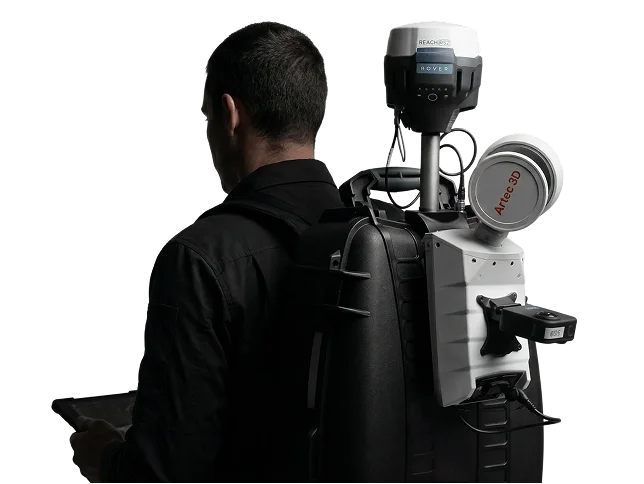
Traditional terrestrial LiDAR scanners must remain stationary while scanning, and can only be moved into new positions between scans. SLAM (Simultaneous Localization and Mapping) is a set of software operations that overcome this limitation and allow LiDAR scanners to capture data while continuously moving. While there are numerous operations at play, SLAM essentially combines the LiDAR capture method with alignment methods that are similar to those used by structured light handhelds, recognizing and matching geometric features for instance. The ability to capture data while moving allows SLAM systems to be deployed in many more ways than traditional LiDAR. SLAM scanners can be mounted to airplanes, drones, vehicles, and robots to cover larger areas and access spaces not reachable by terrestrial systems. They can also be mounted to objects like extension poles, worn on backpacks, or simply held in hand.